BUILDNER × CITY OF VANCOUVER × UBC SALA / HIGHER BUILDINGS POLICY REVIEW — INTERNATIONAL ARCHITECTURE COMPETITION
TERRITORY: xʷməθkʷəy̓əm · Sḵwx̱wú7mesh · səlilwətaɬ COMPETITION MONOGRAPH #VTC-2026
Vancouver Tall Challenge · Building Higher Downtown Consolidated CBD Block: 79.2 m × 144.8 m (260 ft × 475 ft) Height Envelope: 244 m – 305 m (800 – 1000 ft)

The Rainforest Commons.
A Breathing Timber Supertall.

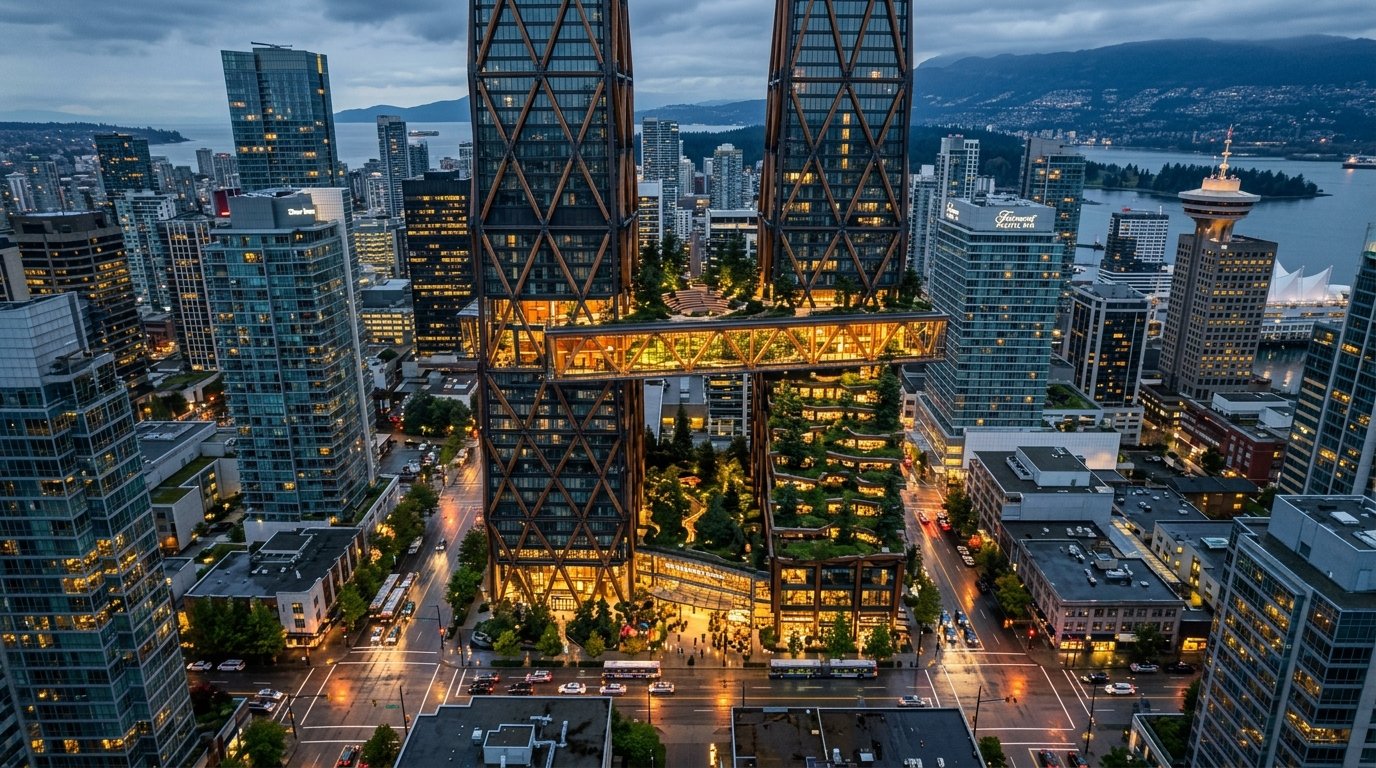
Named after K’emk’emeláy—the Sḵwx̱wú7mesh (Squamish) word for the site of Vancouver meaning “place of many maple trees”—this proposal rejects the placeless glass monolith. By carving the block into two aerodynamically tapered timber-hybrid spires linked by a +140m Sky Commons Park and crowned by a free +298m Public Cloud Forest Observatory, the project delivers 9.5 FSR of high-employment space, 40% non-market workforce housing, and a monumental Coast Salish glulam rain canopy connected directly to the subterranean SkyTrain network.

298m / 246m Twin Tapered Spires
9.5 FSR Employment (≥9.0 Req)
245,400 m² Total GFA (21.4 FSR)
-44% CO₂e Mass-Timber Hybrid
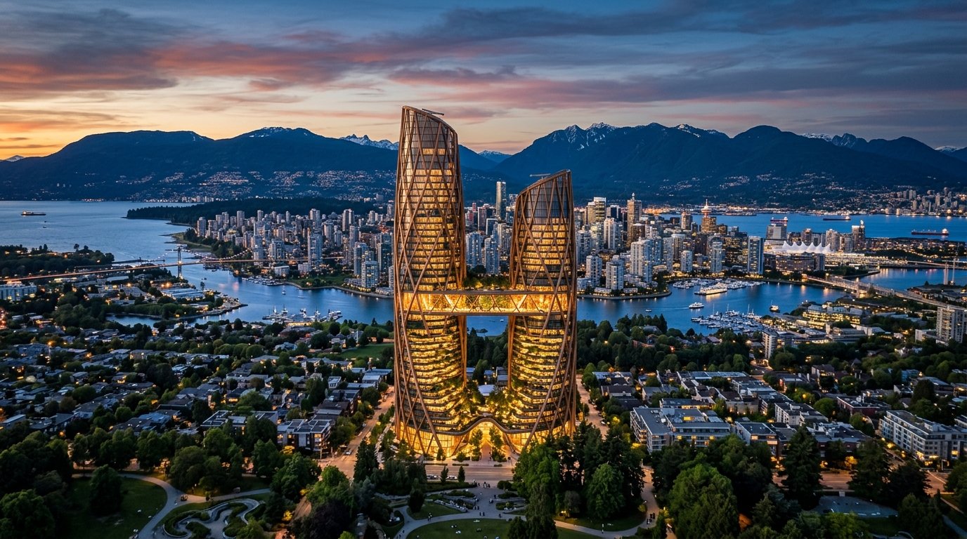
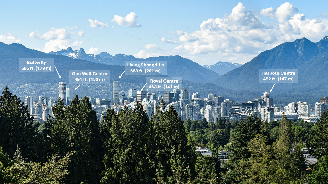
Queen Elizabeth Park Viewpoint looking north across Downtown Vancouver and The Rainforest Commons Twin Spires
IN-SITU VIEW 01 · QUEEN ELIZABETH PARK VIEWPOINT (REQUIRED BRIEF VIEW) — Looking North toward Burrard Inlet & The Lions. The 28m sky slot between the twin spires preserves North Shore mountain ridgeline continuity. [Click Image to Inspect Full Scale]
01 / Design Thesis

From View Cone Obstacle to Vertical Democracy.

Since 1997, Vancouver’s Higher Buildings Policy has carefully balanced density with mountain views and human-scaled streets. Today, as housing and employment pressures intensify, our proposal answers the City of Vancouver and UBC SALA’s question—“How can height strengthen the qualities that make Vancouver special?”—by turning verticality into an instrument of public generosity, rain shelter, and ecological repair.

40%
Human-Scale Experience

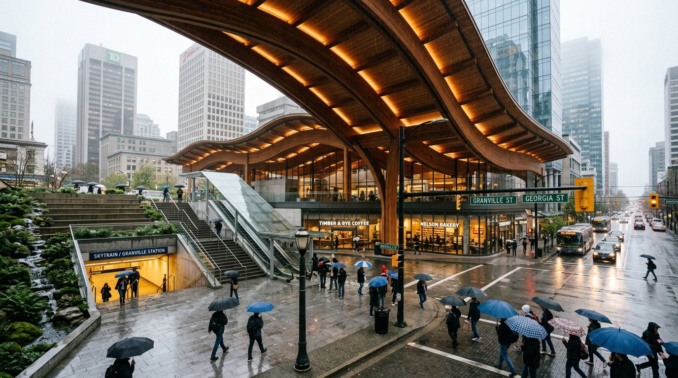
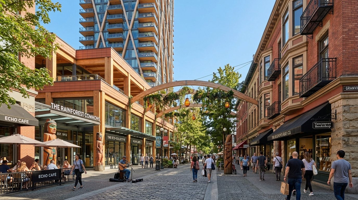
A soaring 18m Coast Salish glulam rain canopy shelters 78% of the ground plane from Vancouver’s 165 rainy days/year. A carved diagonal galleria links the NW Plaza to the sunken SW SkyTrain portal, while a 4-story brick-and-timber podium honors the South Heritage High Street.

30%
Cultural Context & Nature

Rooted in Coast Salish longhouse tectonics and vertical temperate rainforest biomes—from sword-fern bioswales at -6.5m to vine maples at +140m and subalpine mountain hemlocks at +298m—celebrating Vancouver as a “City in Nature” on unceded Musqueam, Squamish, and Tsleil-Waututh land.

20%
Excellence in Design

Replaces generic all-glass curtain walls with an expressed Composite Steel & Cross-Laminated Timber (CLT) Diagrid Exoskeleton. Sequestering 28,400 tonnes of CO₂e, the split-spire form cuts windward drag by 38% and casts zero net-new midday shadow on the South Retail High Street.

10%
Urban Integration & Mobility

Delivers a direct Level B1 subterranean transit concourse into the neighboring SW SkyTrain station, a 1,200-stall commuter bike vault, and 100% concealed underground freight loading accessed exclusively from the North-East lane—keeping sidewalks 100% pedestrian.

Official Competition Base Documentation (Click Any Sheet to Inspect)

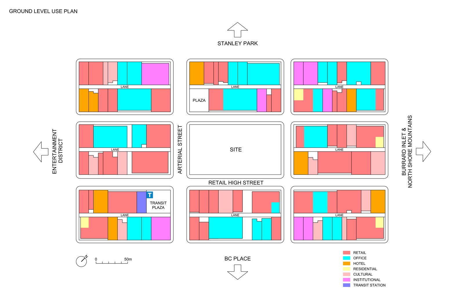
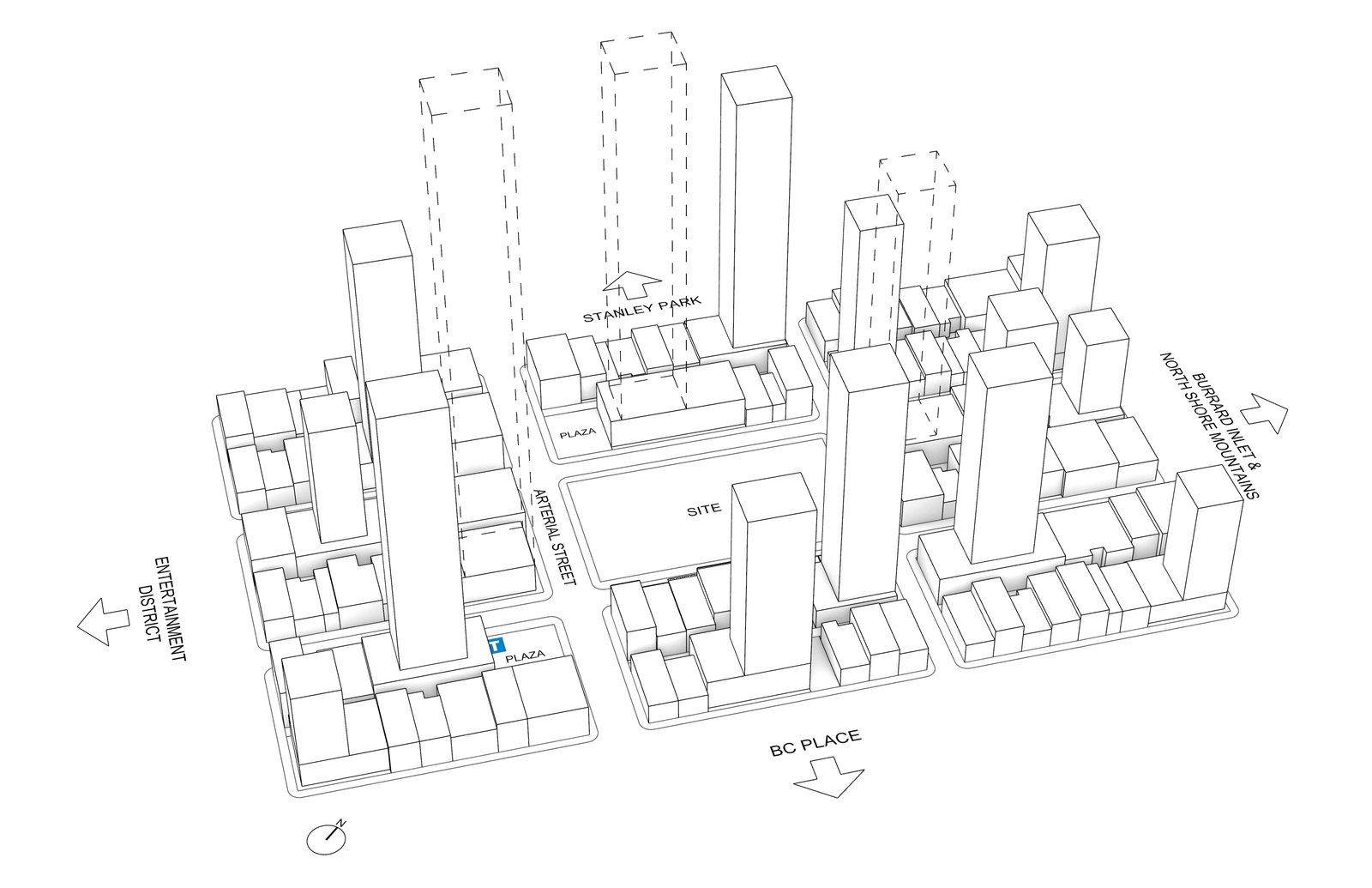
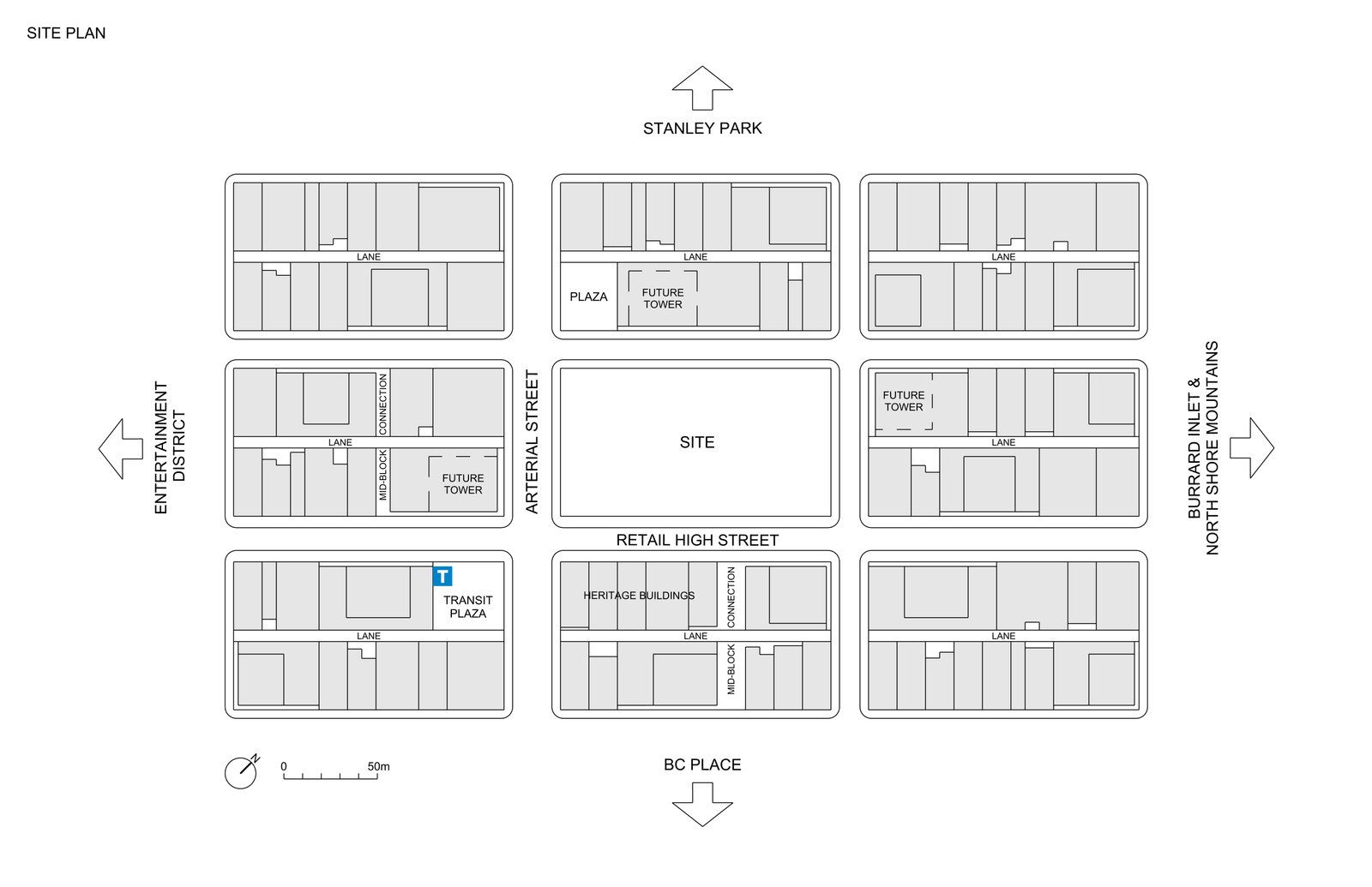
Site Plan, Ground Level Use Plan, 3D Massing Context & Queen Elizabeth Viewpoint

79.2m × 144.8m Block · 244–305m Context
Official Competition Site Plan 01. Official Site Plan (144.8m × 79.2m)
Official Ground Level Use Plan 02. Ground Level Use Plan Context
Official 3D Base Model 03. 3D Context Model (244–305m Towers)
Queen Elizabeth Park Viewpoint Reference 04. Queen Elizabeth Park Viewpoint Ref
02 / Form & Morphology

How the Form is Carved by Mountains, Sun, Wind & Rain.

Every line of The Rainforest Commons is a direct physical response to Vancouver’s microclimate and urban fabric. Drag the interactive slider or click through the 5 stages of formal evolution below to see how a 245,400 m² supertall is sculpted into a human-scaled ecosystem.

Interactive Massing & Form Slider

Five Operations of the Vancouver Supertall

DRAG TO SCULPT THE FORM STAGE 01 → STAGE 05
STAGE 05 / 05

Structural Outrigger Bridge at +140m & Public Cloud Forest at +298m

03 / Architectural Storytelling

Six Chapters of Human Life in the Vertical Forest.

Use the chapter tabs, navigation arrows, or the bottom timeline slider to journey through the six chapters of our narrative—from the rainy subterranean SkyTrain portal to the sunlit heritage laneway and the 298-meter summit conservatory.

04 / Vertical Ecosystem

Inspect Every Altitude from -15m to +298m.

Select any elevation zone on the left ruler or click directly on the sectional diagram to inspect programmatic floor areas, FSR density contributions, and structural engineering across all 78 levels.

+298m CROWN +246m SOUTH SKY COMMONS (+140m) 9.5 FSR EMPLOYMENT B1 SKYTRAIN & RAIN CANOPY
ALTITUDE +245m TO +298m | LEVELS 69–74

Crown Cloud Forest Observatory & Hydronic Damper

Floor Area (GFA) 6,900 m²
Density Contribution 0.6 FSR
Structural System Glulam Diagrid + TLCD
    SITE AREA: 11,468 m² (79.2m × 144.8m) TOTAL PROJECT GFA: 245,400 m² (21.4 FSR)
    05 / Technical Drawings

    Precision CAD Plans, Sections & Engineering Studies.

    Complete architectural deliverables set recommended on Page 30 of the competition brief. Switch between the 5 technical sheets below and use the zoom controls to inspect structural grids, floorplate depths, and the Level B1 SkyTrain tunnel connection.

    07 / Submission Boards

    Four A2 Landscape Presentation Panels.

    Formatted in compliance with Page 27 of the Buildner competition brief: four (4) A2 landscape presentation panels synthesizing urban context, technical drawings, environmental performance, and human-scale storytelling.

    PANEL 01 / 04 · URBAN THESIS, SKYLINE & INDIGENOUS GROUND THE RAINFOREST COMMONS (K’EMK’EMELÁY SPIRE)
    Board 1 Skyline
    1.1 VIEW CONE & MASSING EVOLUTION

    Splitting a single 300m block into twin tapered spires (298m & 246m) opens a 28m North-South view corridor and reduces wind wake by 38%.

    1.2 MASTER SITE PLAN (1:500)

    79.2m × 144.8m CBD consolidation weaving the NW Plaza to the SW SkyTrain station under a Coast Salish glulam rain canopy.

    1.3 RECONCILIATION & STEWARDSHIP

    Co-curated cultural pavilion & ethnobotanical forest honoring xʷməθkʷəy̓əm, Sḵwx̱wú7mesh & səlilwətaɬ Nations.

    PANEL 02 / 04 · THE FOREST FLOOR, TRANSIT LINK & HERITAGE EDGE HUMAN-SCALE EXPERIENCE (40% JURY WEIGHT)
    Board 2 Transit Plaza
    2.1 LEVEL B1 SKYTRAIN CONCOURSE

    Direct subterranean portal linking the SW Transit Station into a daylit sunken rainforest amphitheater and 1,200-bike hub.

    2.2 SOUTH HERITAGE INTERFACE

    4-story brick-and-timber podium matches historic cornice lines on Retail High Street with an active mid-block cultural mews.

    2.3 ZERO-CONFLICT SERVICING

    100% below-grade freight loading & waste management accessed via dedicated NE lane helix ramp.

    PANEL 03 / 04 · TECTONIC SECTIONS, FLOOR PLANS & 9.5 FSR CORE ARCHITECTURAL & STRUCTURAL EXCELLENCE
    Board 3 Mid-City Aerial
    3.1 PRIMARY CROSS SECTIONS A-A & B-B

    Full 316m structural cut (-18m to +298m) illustrating double-deck express shuttles, outrigger trusses, and vertical parks.

    3.2 TYPICAL PLANS (L15 / L38 / L55)

    108,950 m² (9.5 FSR) timber-hybrid employment trunk + 94,000 m² (8.2 FSR) mixed-income housing (40% non-market).

    3.3 HYBRID MASS-TIMBER DIAGRID

    48% mass timber by volume (CLT slabs + glulam diagrid sleeves), cutting embodied carbon by 44% (-28,400 t CO₂e).

    PANEL 04 / 04 · VERTICAL DEMOCRACY, MICROCLIMATE & 2027 POLICY CROWN OBSERVATORY & POLICY REFLECTION
    Board 4 Crown Observatory
    4.1 +298m CLOUD FOREST OBSERVATORY

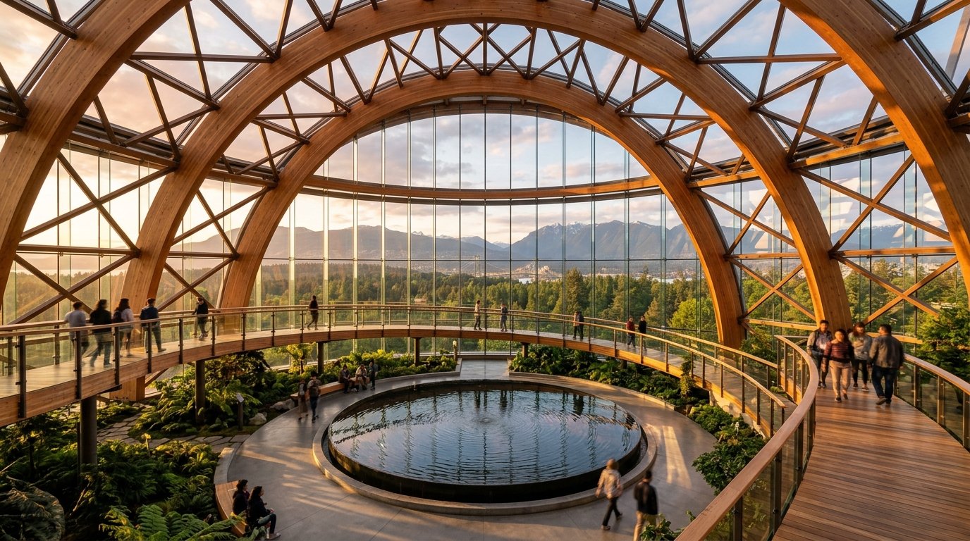
    Top 6 floors dedicated to a free public botanical conservatory & 800-ton rainwater Tuned Liquid Damper.

    4.2 WIND & SOLAR PERFORMANCE

    98.4% plaza sitting comfort (<4m/s); zero new equinox shadow on South Retail High Street between 10am–3pm.

    4.3 HIGHER BUILDINGS POLICY CHARTER

    5 actionable policy rules tying supertall height bonuses directly to public crown access, rain canopies, and embodied carbon caps.

    08 / Policy Reflection

    The 2027 Vancouver Higher Buildings Charter.

    As requested on Page 30 of the brief, our proposal formulates five concrete urban policy mechanisms for the City of Vancouver’s ongoing Higher Buildings Policy Review—defining what a truly “Made-for-Vancouver” supertall must give back to the city.

    Rule 01 · Public Crown Mandate

    Civic Supremacy at the Summit

    Any downtown tower permitted above 240 meters must dedicate at least 5% of its upper-tier GFA (including its highest habitable levels) to free, ticketless public cultural, educational, or botanical observatory space reachable via direct street/transit express shuttles.

    → Applied at +140m & +298m
    Rule 02 · Rain-Canopy Ratio

    75% All-Weather Ground Porosity

    In response to Vancouver’s temperate rainforest climate, supertall developments must provide continuous, architecturally expressive overhead rain protection across a minimum of 75% of their public plaza and transit interface footprint, maintaining pedestrian wind speeds below 4.0 m/s.

    → 78% Glulam Canopy Coverage
    Rule 03 · Biogenic Carbon Cap

    Mass-Timber Hybrid Bonus

    Height beyond 200 meters must be earned through verified whole-life carbon reductions: requiring a minimum 40% biogenic or low-carbon composite structural share (CLT floor plates / glulam hybrid diagrids) to achieve at least a 40% reduction in upfront embodied carbon.

    → -44% Embodied CO₂e Achieved
    Rule 04 · Solar & View Carving

    Split-Massing & High Street Sun

    Full-block supertall consolidations must split tower floorplates above 120 meters to preserve a minimum 25-meter North-South sky slot, while tapering southern facades to guarantee zero net-new equinox shadow on designated Retail High Streets between 10:00 and 15:00.

    → 28m View Slot + 68° Solar Taper
    Rule 05 · Unceded Stewardship

    Host Nations Co-Governance

    Every supertall rezoning within the CBD must allocate permanent, rent-free cultural, gallery, or ecological stewardship space at grade or sky-park level co-governed with the xʷməθkʷəy̓əm, Sḵwx̱wú7mesh, and səlilwətaɬ Nations, embedding Indigenous place-making into the skyline.

    → Coast Salish Pavilion & Biomes